Milford Sound and all the way to Christchurch
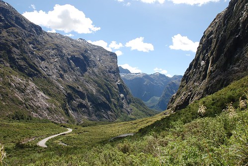
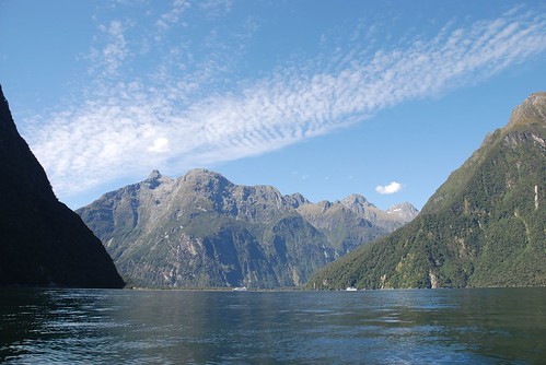
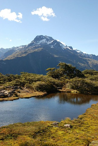
The last time I wrote in this blog, I was saying how awesome Milford Sound was and that I would put up some photos next time I got online. Well, today is the day! It's picture time! Here's a sample of the drive up to Milford Sound from Te Anau. The weather was perfect and the scenery stunning...
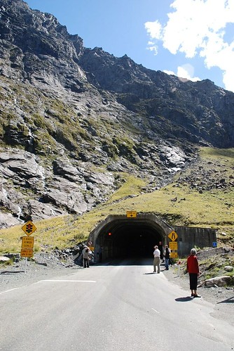
 The super long, scary tunnel I described in my last blog entry is in the photo below. Bus-loads of people stop and admire both the entrance to the tunnel and the random birds looking for a free meal (guaranteed from the bus-loads of folks).
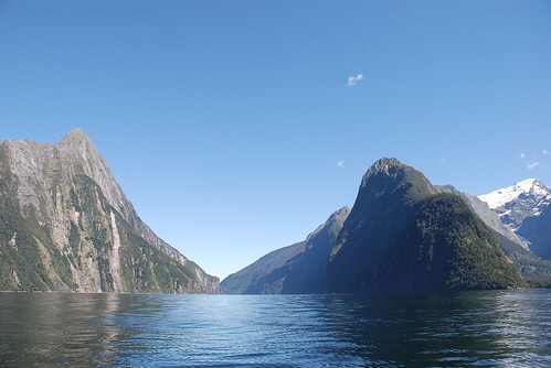
 After arriving in Milford Sound, I went for a run to take in some fresh (and cold) ocean air. It was so lovely to be there and breathing in the surroundings. This place has such a dramatic and deep historical feel.
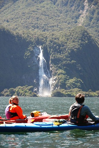
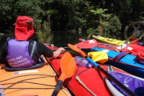
The following day, Beth and I took a kayaking tour around the sound. I would have preferred to take a couple of kayaks out without the guided tour, but it isn't possible to rent kayaks on your own in Milford Sound. Having been a sea kayaking guide myself, it was interesting to sit and be the tourist.
After arriving in Milford Sound, I went for a run to take in some fresh (and cold) ocean air. It was so lovely to be there and breathing in the surroundings. This place has such a dramatic and deep historical feel.
The following day, Beth and I took a kayaking tour around the sound. I would have preferred to take a couple of kayaks out without the guided tour, but it isn't possible to rent kayaks on your own in Milford Sound. Having been a sea kayaking guide myself, it was interesting to sit and be the tourist.
 We lucked out with amazing weather once again. The kayaking guide made us all put on wetsuit tops, thermal underwear and a waterproof jacket. I went along with it until 30 minutes into our paddle and took off most of the layers so I wouldn't sweat to death.
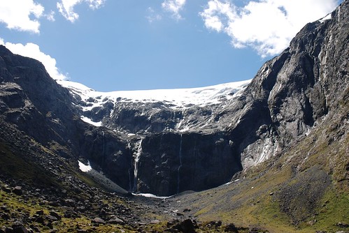
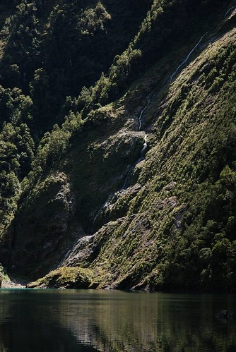
 There is a big waterfall just beside the 'town' of Milford Sound, and apparently way back when, some smart folks thought they would dam the waterfall at the top to generate electricity. The dam lasted for a short time before being blasted out by a surge in water due to one of the many, many heavy rainfalls.
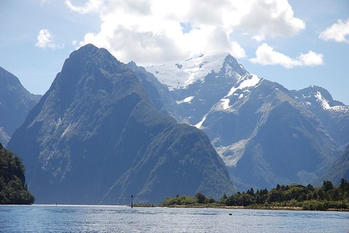
 Our guide told us that it rains so much in the area that his job is usually spent trying to convince his kayakers that there are mountains around the sound... It would be so neat to see the area full of fog and rain, as I imagine it would have such a different mystical feel, however, I was pleased to be paddling under the warm sun on the calm water.
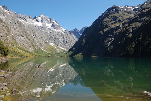
 Near the end of our tour, we paddled up the river to the tip of the Milford Sound track, under the bridge and through to this amazing little refuge. That was my favourite part of the kayaking trip.
 We made our way back to the boat dock and realized that it was only the early afternoon and that there was plenty of time left do pack in some more adventure for the day....
 Back through the scary tunnel and out to a hike called Key Summit. I put my running shoes on and made fire tracks up the trail to the top in record time! The trail was awesome, and the views at the top were quite a nice reward.
 I think at this point, when I was smelling a little less than shower-fresh, the sand flies tend to stay away. Good times.
 Sometime during the afternoon, I realized that I had left our breakfast grocery bag back at the hostel in Milford Sound. We didn't think we could survive without our oatmeal and seeds, so we drove back through the scary tunnel to the hostel, rescued our grocery bag, ate expensive pizza at a pub in Milford Sound, and then drove back through the scary tunnel AGAIN. That's four passes through the scary tunnel within 24 hours. The novelty was wearing off, but it was still scary.
We camped at a museum/campground that night and awoke the next morning to SWARMS of black flies. The sun was out and it was H-O-T, but I kept my long johns on just to keep the bugs out. Yikes! The little pesky flies were relentless in their search for fresh blood. We escaped the wrath of the bugs by hiking up to Marian Lake, which was pretty spectacular. The lake and surrounding peaks looked just like scenes from some of the hikes I've done in Banff National Park.
Sometime during the afternoon, I realized that I had left our breakfast grocery bag back at the hostel in Milford Sound. We didn't think we could survive without our oatmeal and seeds, so we drove back through the scary tunnel to the hostel, rescued our grocery bag, ate expensive pizza at a pub in Milford Sound, and then drove back through the scary tunnel AGAIN. That's four passes through the scary tunnel within 24 hours. The novelty was wearing off, but it was still scary.
We camped at a museum/campground that night and awoke the next morning to SWARMS of black flies. The sun was out and it was H-O-T, but I kept my long johns on just to keep the bugs out. Yikes! The little pesky flies were relentless in their search for fresh blood. We escaped the wrath of the bugs by hiking up to Marian Lake, which was pretty spectacular. The lake and surrounding peaks looked just like scenes from some of the hikes I've done in Banff National Park.
 Later that afternoon, we drove back down to Te Anau and checked our email and heard word from Becky that she'd gotten a hotel room for all of us in Christchurch. OOoooooh, a real big bed! After four nights of tenting, we were looking forward to anything besides hard ground. This became especially apparent after our crazy awful comping experience later that night in Cromwell, east of Queenstown. The wind was blowing so hard that it was lifting me off the ground. There was this huge light from the main building blinding me in my attempts to sleep. And there was the lingering reggae bass tunes from a van nearby. After hours of trying to get to sleep, I finally gave up and moved into the front seat of the car. Ahhh, peace and quiet... The next morning, I knew it was time to move on when I spilled my full mug of tea onto the floor of the car. This place is bad luck. LET'S GO!
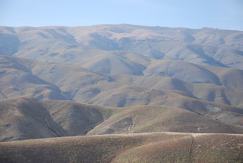
We selected a highway path that put us past some neat looking scenery including the plumpy mountains here:
Later that afternoon, we drove back down to Te Anau and checked our email and heard word from Becky that she'd gotten a hotel room for all of us in Christchurch. OOoooooh, a real big bed! After four nights of tenting, we were looking forward to anything besides hard ground. This became especially apparent after our crazy awful comping experience later that night in Cromwell, east of Queenstown. The wind was blowing so hard that it was lifting me off the ground. There was this huge light from the main building blinding me in my attempts to sleep. And there was the lingering reggae bass tunes from a van nearby. After hours of trying to get to sleep, I finally gave up and moved into the front seat of the car. Ahhh, peace and quiet... The next morning, I knew it was time to move on when I spilled my full mug of tea onto the floor of the car. This place is bad luck. LET'S GO!
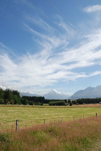
We selected a highway path that put us past some neat looking scenery including the plumpy mountains here:
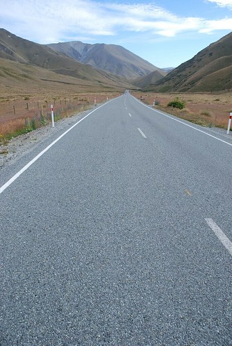
 the patch of highway here:
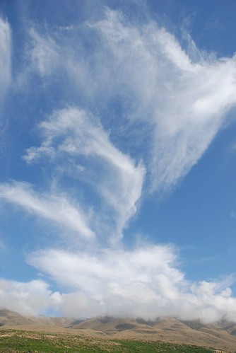
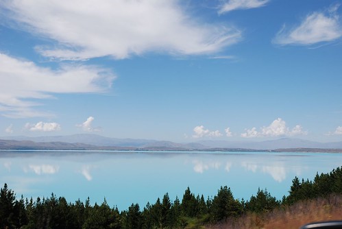
 some cool clouds and landscapes here:
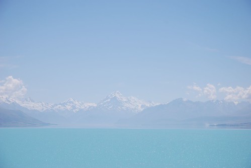
 and Mount Cook, in the background, here:
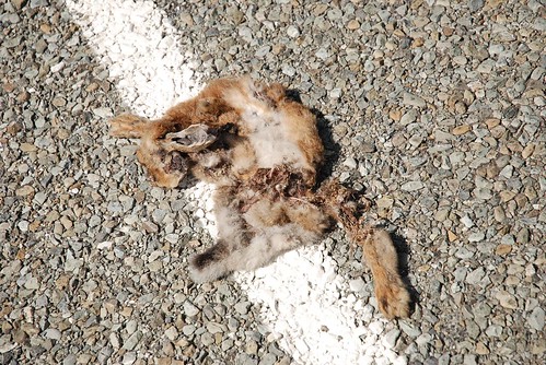
 Roadkill is ever present at all times. Mostly possums, but some bunnies and other random small animals. There are at least twenty or thirty seen per day. I can't really tell what this one is, but I almost stepped on it when I was taking some pictures of the Mt. Cook area. Mmm...
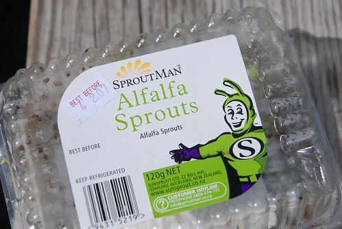
 I think SproutMan should be our mascot. He certainly serves up some damn good sprouts for our sandwiches at lunch time.
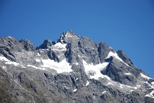
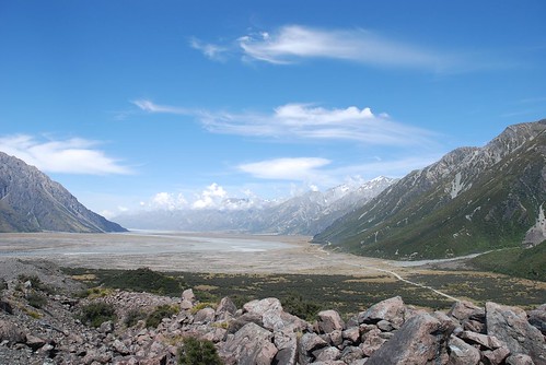
 Next to Mt. Cook is Mt. Tasman, and the Tasman Valley Glacier which is 29 kms long. Most of it is hiding under dirt and grit, so it looks like a normal valley, but when you look up close it's super cool.
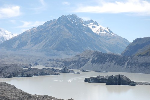
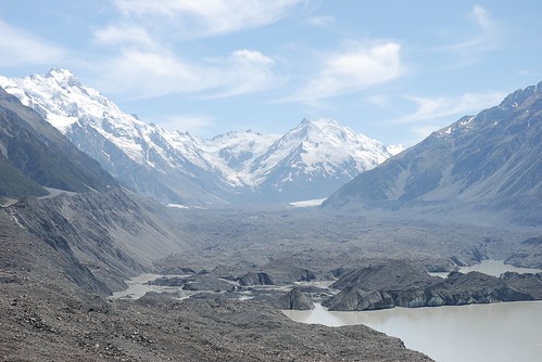 To get some perspective on how big the glacier is, and how big the river here is, just take a little looksie at the photo below and check out the tour boat speeding along and darting around chunks of glacier.
 Oh yes, did I mention that it was stunningly beautiful and sunny once again?? I'm pushing my luck here aren't I?
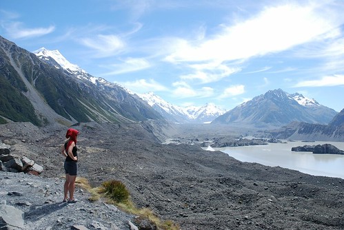 The view from the glacier area back towards Mt. Cook township was beautiful. The valley is very similar to the Fraser Valley in BC, where the valley floor is flat (due to glacier movement from way back when), and the mountains jet up from the sides.
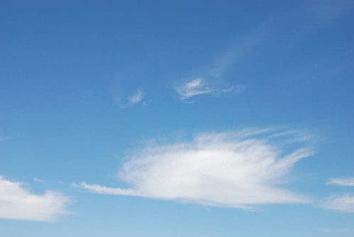
 Beth was driving for a while on our way out of the Mt. Cook area, and I took the opportunity to get lost in the clouds causing spontaneous smiles as I saw funny formations in the clouds like this two-eyed monster here below:
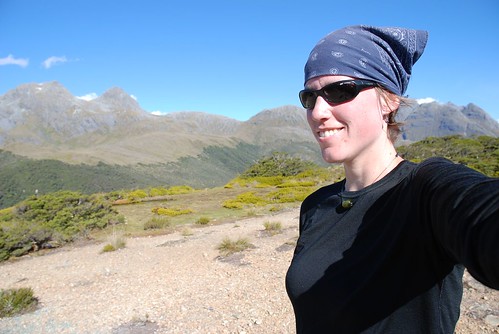
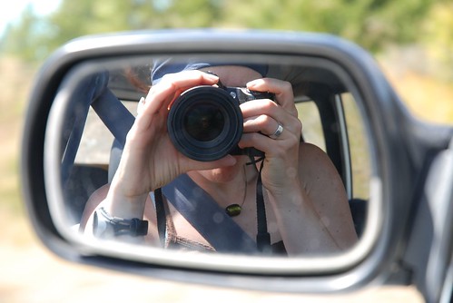
 The cloud gazing also inspired me to get a bit creative with my camera. Here's my self-portrait:
 The glacier lake stemming from the Tasman and Cook valleys was pristinely blue. It was like a trillion light blue crayons had melted in the massive lake making it almost thick in appearance.
 At the base of the blue crayon lake, you can look back and see Mt. Cook and Mt. Tasman. Pretty spectacular scenery, I say.
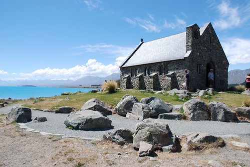
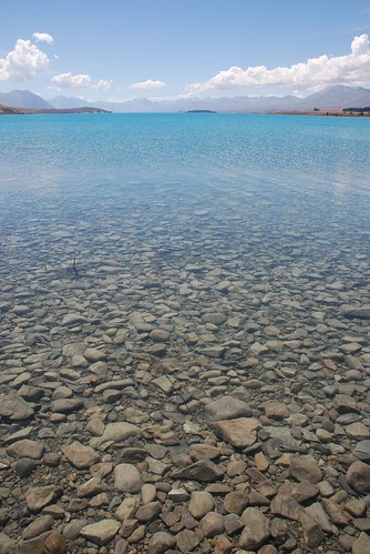
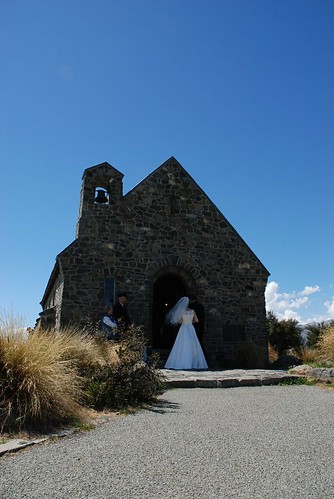
 As if it couldn't get any better, and then it does. The next lake along the road is even brighter blue in colour, and it's got a sweet little church perched on the tip. Church of the Good Sheppard:
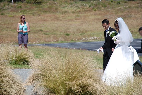
 As I was creating photo evidence of this amazing place, Beth noticed that a wedding was about to happen at the cute church on the lake shore. We stuck around long enough to see the nervous bride and groom approach the church doors and await the formal ceremony. The tourists standing around were a bit tacky, but I admit that I was one of them.... I stayed long enough to get these two photos of the event, both of which I quite like and makes me consider doing wedding photography....
 The remainder of the drive up to Christchurch was pretty uneventful. The landscape changed to resemble the prairies in a way; it was flat, dry and few curves in the road.
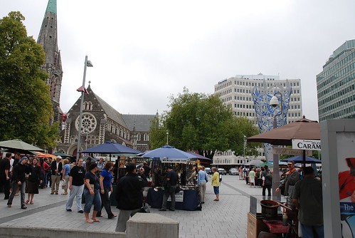
Upon arrival in Christchurch, we settled down in our hotel room (so swanky, thanks Becky!), and watched some ridiculous television (this is why I don't own a t.v.). The town of Christchurch isn't particularly stimulating or interesting. It felt like Saskatoon, for some reason. Just a bunch of cement buildings and a bit of flare in a few spots to make it spunky, sort of. Anyway, we spent most of our time outside of Christchurch, with the exception of our walks to the hospital to see Johnny; we walked along the river and to Cathedral Square for the daily tourist market.
The remainder of the drive up to Christchurch was pretty uneventful. The landscape changed to resemble the prairies in a way; it was flat, dry and few curves in the road.
Upon arrival in Christchurch, we settled down in our hotel room (so swanky, thanks Becky!), and watched some ridiculous television (this is why I don't own a t.v.). The town of Christchurch isn't particularly stimulating or interesting. It felt like Saskatoon, for some reason. Just a bunch of cement buildings and a bit of flare in a few spots to make it spunky, sort of. Anyway, we spent most of our time outside of Christchurch, with the exception of our walks to the hospital to see Johnny; we walked along the river and to Cathedral Square for the daily tourist market.
posted by Dee @ 1:15 p.m.
0 comments
![]()
![]()

0 Comments:
Post a Comment
<< Home